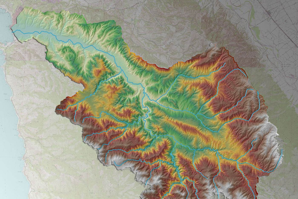
Balance Hydrologics was the lead for an inter-disciplinary team that was selected to prepare an updated flood control plan for the Carmel River in County Services Area 50, which encompasses the north overbank areas of the river from Mission Fields upstream to Val Verde Drive in the County of Monterey, California. The study included a comprehensive floodplain mapping update and re-evaluation of the flood protection measures needed to protect CSA-50 from a range of flood events, with particular emphasis on the 1-percent chance (100-year) flood used by the Federal Emergency Management Agency (FEMA) under the National Flood Insurance Program.
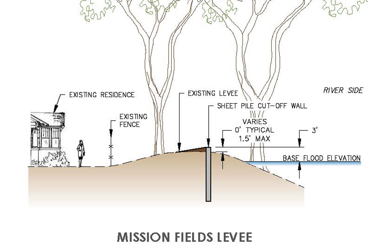
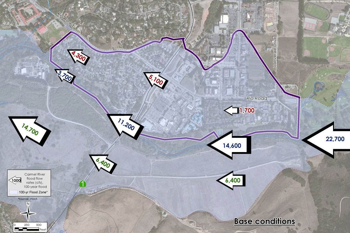
The location encompasses an area that includes nearly all the repetitive loss properties in the County. Balance coordinated work by sub-contractors to compile revised topographic base mapping tied to established FEMA benchmarks, complete utility surveys (including the first comprehensive storm drain infrastructure mapping), and geotechnical work to characterize the condition of the extensive, non-documented levee system. The data was used by Balance Hydrologics’ modelers to create hydraulic models to assess anticipated flood elevations at all points along the CSA-50 boundary. Riverine modeling was carried out in two distinct modes: 1) steady-state one-dimensional HEC-RAS to show continuity with past NFIP mapping products and 2) non-steady state two-dimensional HEC-RAS (5.0 Beta) and SRH-2D to give insight regarding the complexity of main channel to floodplain break-out points, overbank flow patterns, and tailwater implications associated with sea level rise and the large lagoon environment at the river mouth. Break-out points and flowpaths were also assessed using land-based and aerial photography from the large historical flood events in March 1995 and February 1998. As the project planning matrix included extensively revised perimeter protection elements, the work included interior drainage modeling for the lateral canyons and storm drain systems that drain to and across the north overbank floodplain areas. High riverine tailwater and pipe system conveyance constraints led to the selection of XP-Storm with two-dimensional overland flow routing as the interior drainage modeling package. The combined riverine and interior drainage modeling output was utilized to identify and rank range of potential infrastructural enhancements addressing both flooding sources and three distinct zones of flood hazard. Screening criteria included environmental review for potential biological and cultural resources impacts, ease of access/property rights, and multi-functional aspects with increased potential for funding. Preferred alternatives were selected for two levels of risk tolerance, and preliminary project plans and cost estimates were then developed for each element by hazard zone and flooding source. The entirety of the work was compiled in a comprehensive plan of flood control, and Balance project managers worked closely with County staff to coordinate and conduct public workshops and County Board briefings throughout.